Ship handling simulator

Admin

Dunkirk pilots are equipped with the latest generation of professional ship handling simulator inaugurated in September the 8th 2015, the model is the 5000 Pro Navitrainer from TRANSAS company, world leader in simulation systems, and e-navigation maritime surveillance.

Overall concept

The simulator incorporates all the latest computer modeling technology and high-definition display. Fruit of 20 years of experience acquired by the supplier, it has the following specifications:

  • A senior instructor room with projector and debriefing tools.
  • A realistic navigating bridge with a visual of 210 ° and a rear viewing channel to optimize the realism of maneuvers.
  • A room dedicated to the server computer
  • With local administrative meeting room and toilets.
Simulation du futur terminal méthanier (PILOTAGE DE DUNKERQUE)

Training

This great educational tool initially to give additional training and support for the junior pilots following an elaborate planning and with an instructor named among the most experienced pilots.

It also allows to anticipate changes in the environment of the port of Dunkirk through the strategic future projects, pilots are indeed able to model and to introduce inside existing databases, structures such as new berth to enable validation of new safe navigation conditions, approaches and improving docking conditions for ever larger vessels.

The simulator also allows:

  • Training in ocean navigation and coastal
  • Training with automatic radar plotting aid (ARPA).
  • Training electronic chart display and information system (ECDIS).
  • Training automatic identification system (AIS).
  • Training special operations (tug escort tug, Azipod, emergency maneuvers, etc ..)

Scanning of Dunkirk port & areas

Since 2008, more than 20,000 photos were taken of each of the objects in the environment of the port of Dunkirk and its surroundings. Each of the objects has been precisely located by GPS and scans version day and night were performed, this work provides an optimal degree of precision of the mathematical structure of the place. Hydrographic and bathymetric elements complete this colossal work. The database resulting three-dimensional computer model that recreates an ultra realistic environment and a faithful visual reality.

In 2013, we acquired software capabilities, we can now update existing installations or create environments(berth, terminal etc…) or even planned. This allows pilots to anticipate training for ship handling in all weather conditions, and we modeled the implementation of the LNG terminal even before it was built to accommodate under the best safety conditions the first LNG planned for the last quarter 2015.

The hydrodynamic models

Simulation du futur terminal méthanier (PILOTAGE DE DUNKERQUE)

Mathematical models have components at the heart of any training system. The level of fidelity hydrodynamic models must be extremely realistic.

The collection of vessels modeled by Transas has more than 300 models of ships carrying. All models incorporate a complete reaction to external forces and the known effects of water (bank effect, shallow water, sand banks, ship to ship interaction), wind and others, that can be adapted precisely and add to other effects to each model.

This library is constantly updated and this how we get the model of a ultra large container ships (ULCS) such as CMA CGM Alexander Von Humboldt on which we trained before his first call on 12 August 2015.

New seagull 6000

The simulator receives the latest version of the graphics engine available, the seagull 6000 surpasses all the usual formats in the maritime simulation. The main vectors of performance improvement include the following:

  • Rendering wakes and bow waves
  • Rendering thrusters
  • Reflections (sun, port lighting)
  • Fog, follow spots
  • dynamic shadows
  • hiding
  • Interaction fixed elements (waves on piers and buoys)
  • Current viewing
Simulation du futur terminal méthanier (PILOTAGE DE DUNKERQUE)

Video

[hana-flv-player video=http://pilotedunkerque.fr/wp-content/uploads/2015/09/Simulateur.mp4/]

[:]

Portable piloting unit (PPU)

Admin

A Portable Pilot Unit (PPU) can be generally described as a portable, computer-based system that a pilot brings onboard a vessel to use as a decision-support tool for navigating in confined waters. Interfaced to a positioning sensor such as GPS/DGPS and using some form of electronic chart display, it shows the vessel’s position/movement in real-time. In addition, PPUs provide information about the location/movement of other vessels via an AIS interface. Increasingly, PPUs are being used to display other types of navigation-related information such as soundings/depth contours from recent hydro surveys, dynamic water levels, current flow and security zones (no go areas).

Ship handling replay of Capesize vessel with CAT III monitoring

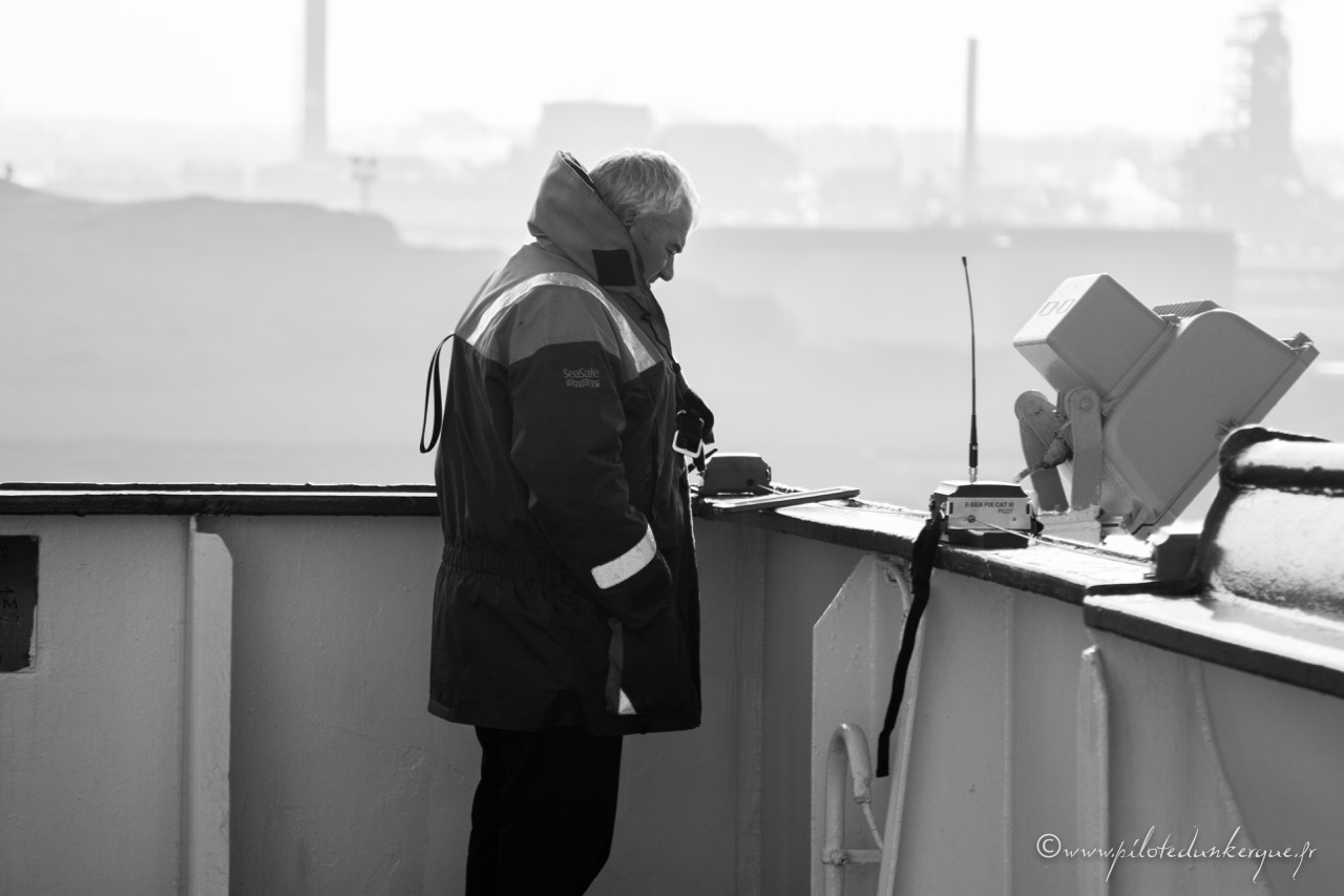
With these advantages, Dunkirk pilots are individually equipped with these units on a media type ipad, each of these tablets is equipped with manufacturer Marimatech Safepilot software world reference in dynamic positioning equipment.

Pilot station also has 4 sets of beacons like CAT ROT & CAT I precision allowing the speed of one centimeter per second and a DGPS positioning accuracy of less than 80 centimeters.

CAT ROT

CAT ROT

The E-Sea Fix CAT ROT is a small and compact pilot unit de- signed for the professional pilot.

The advantage of using the AIS pilot plug as data source is the limited size, weight and cost of the system the pilot has to bring.

The data provided over the AIS pilot plug is however compro- mised to a degree where essential data as real time rate of turn (ROT) and reliable prediction are not available.

The CAT ROT unit is however much more than just a pilot plug repeater.

The CAT ROT improves the heading resolution and measures a reliable real time ROT making the Pilot Plug a suitable data source for pilot systems.

This is obtained via an integrated rate-sensor, micro proces- sor and intelligent kalman filtering. The result is an added decimal degree to the heading resolution and a real time, reliable ROT making smooth

Projections of the vessels predicted path with current motion dynamics a reality.

Data is transmitted via Wi-Fi to the pilot tablet / Notebook

CAT I

For operations requiring a good quality positioning and speed measurements the standard pilot plug data can be compro- mised due to the resolution and more important the accuracy of the entered antenna offsets in the AIS. To eliminate this risk the CAT ROT unit can a be used in combination with a separate good quality positioning unit – the CAT I.

The CAT I is a stand-alone high accuracy GPS receiver with the capability of GPS/GLONASS and available SBAS systems such as EGNOS, WAAS, MSAS, GAGAN etc.

CAT ROT / CAT I combination provides:

CAT ROT:

– Heading with decimal degrees – ROT < 0,5 deg

– AIS targets

CAT I :

– Speed 1cm/sec (RMS)

– Position (GPS/GLONASS/SBAS) acc.< 0.8 m (RMS)

CAT III

We also have a beacon type E FIX-SEA CAT III (L1 / L2) RTK GNSS (GPS + GLONASS + Gailileo).

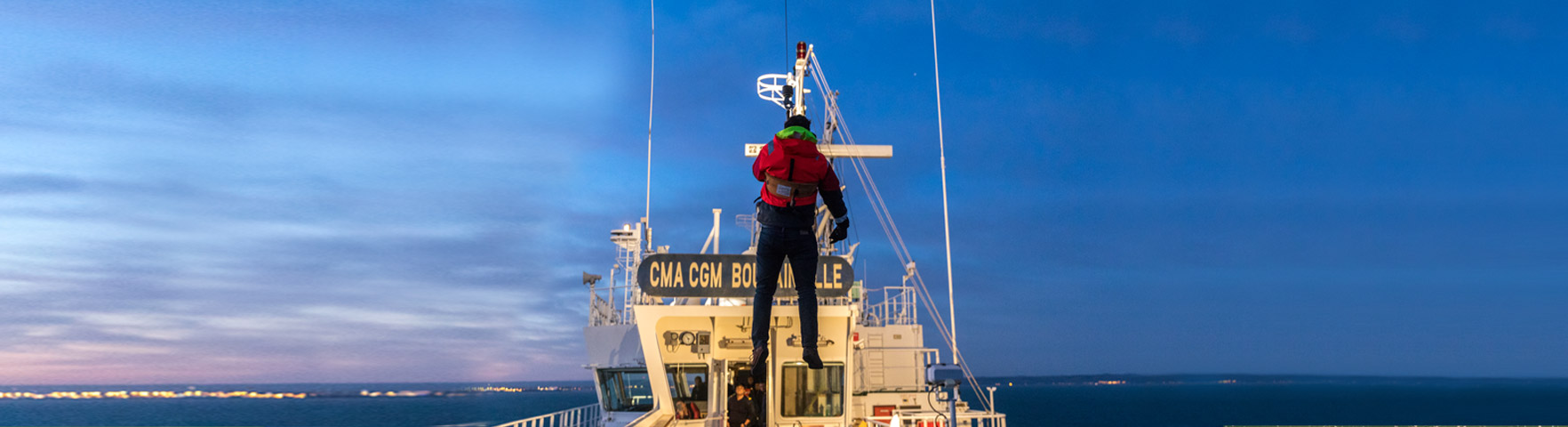
To ensure the operation of very large ships in the port of Dunkerque, such as Capesize vessels crossing the Charles de Gaulle Lock, the ship handling of Ultra large containers ships ULCS of 400 meters in the West port and the Qflex type and Qmax LNG vessels entering the Dunkerque LNG terminal in Le clipon area.

For the very high end piloting applications demanding centimeter accuracy as well as heave, pitch and roll monitoring, MARIMATECH offers the E-Sea Fix CAT III units. This is particularly important for sensitive operations such as LNG operations, side-by-side berthings off shore, challenging locks, etc.

The E-Sea CAT III unit is based on a thought through and well proven design ensuring extreme robustness, accuracy and reliability required for such operations.

The CAT III features:

  • The CAT III is completely independent of the ship’s sensors.
  • Integrated all-in-one unit ensuring exceptional reliability
  • Minimal set-up time
  • Extreme position accuracy – less than 2 cm RMS.
  • Extreme heading precision 0.01 deg
  • Low weight
  • Kalman filtering in the unit eliminates errors caused by WIFI package transfer
  • Heave, pitch and roll monitoring and logging (optional)
  • Automatic base line calculation
  • Flexible software choice, but we deliver dedicated pilot software for multiple platforms, including the iPad.
  • Custom charts as required
  • Large range of options for data integration 1via base station or internet (wind, current, tide, chart server, VTS as well as tug position, aspect, RPM, hawser load etc.)
  • Easily portable in a padded back pack or hard case.
  • GPS and Glonass L1/L2 RTK and prepared for Galileo.
IMG_4390
1 2